

Let's map out your needs...
Platform-Based GIS & 3D Mapping Solutions Built for Precision, Scale, and Impact
- Helping You To Navigate Your Path Towards Success
Mapex stands at the forefront of GIS innovation, delivering scalable geospatial solutions that address real-world challenges. From high-precision mapping to advanced 3D visualization, we transform spatial data into powerful decision-making tools.
Our tailored services serve sectors like urban planning, water resources, utilities, and infrastructure. Leveraging Ai and ML models, we help governments, enterprises, and institutions unlock efficiencies and smarter service delivery. Whether it’s intelligent dashboards, automated surveys, or digital twins, our solutions align with your goals and deliver measurable value. With validated, enriched data and a focus on sustainability and governance, we offer next-generation GIS services. Mapex empowers stakeholders to plan better, act faster, and manage smarter—enabling a world that evolves with intelligence and clarity.
Empowering Governance Through Geospatial Intelligence
Mapex supports smarter urban planning, land records, and public infrastructure with accurate mapping, spatial data insights, and scalable GIS services built for policy-driven impact.

Enterprise-Grade Geospatial Solutions for Smarter Decisions
From real estate to logistics, Mapex helps enterprises unlock operational clarity through location intelligence, smart mapping, and high-efficiency GIS workflows.

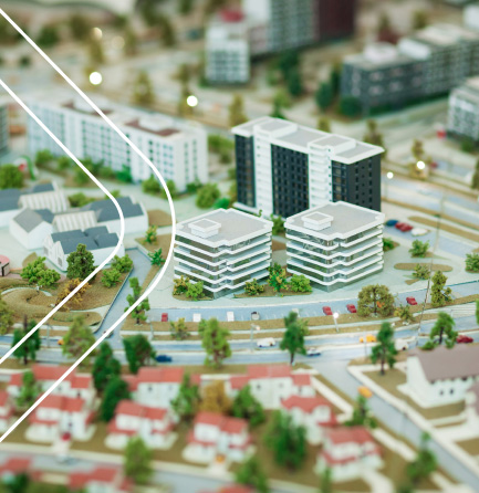
Building the Future with Precision Geospatial Services
From roads and smart cities to utilities and BIM integration, Mapex delivers accurate, scalable GIS services that accelerate infrastructure development and reduce on-ground risks.
Services That Empower
Smarter Planning Real-Time Decision-Making
Our GIS capabilities are designed to deliver high accuracy, seamless integration, and operational efficiency across every sector we serve. Explore our end-to-end geospatial solutions—from smart mapping and validation to dynamic dashboards and Ai-powered insights.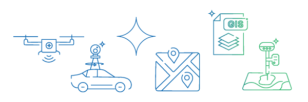
Surveying
UAV and Ai-powered field surveys delivering fast, accurate geographic data collection.
- DGPS survey
- UAV data acquisition
- POI collection
- Asset tagging
- Road network data collection
- Street view mapping solutions

Surveying
GIS Mapping & Engineering
Accurate geospatial data digitization, network modeling, and advanced spatial data analysis.
- Indoor mapping with 360° imagine
- Digitization of data from maps and drawings
- Map digitization Topographic
- Cadastral Parcel
- Data conflation & enrichment
- Terrain mapping
- 2D & 3D feature extraction
- Navigational
GIS Data Engineering
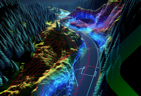
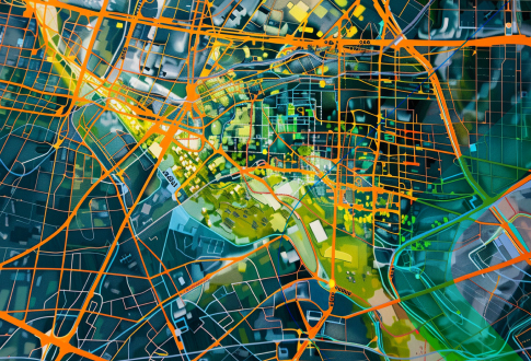
Spatial Analytics
Comprehensive 3D city, indoor, and digital mapping with precise geospatial visualization.
- Data migration from multiple formats into single unified format
- Network data modeling for utilities
- DSM/ DTM, LOS & shaded relief
- Real time terrain mapping
- 3D GIS visualization
- AI/ML based DSS
Mapping
BIM
Complete BIM and CAD services including digital conversion, 3D Modelling, and documentation.
- Paper to CAD conversion
- 2D CAD drafting
- Spool drawings
- 3D Modelling and rendering
- Scan to BIM services
- BIM content and library creation
- Virtual design and construction (VDC)
- As-built documentation
- Design, drafting, modelling and clash detection for Architectural | Structural | Mechanical | Electrical | Plumbing | Firefighting services

BIM
Calling all GIS pioneers, engineers and leaders to build India’s geospatial future together with Mapex.
Join Us